top of page
WA Wildlife Corridors
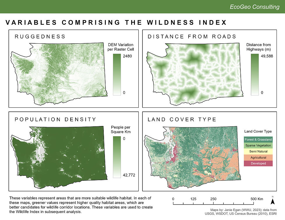
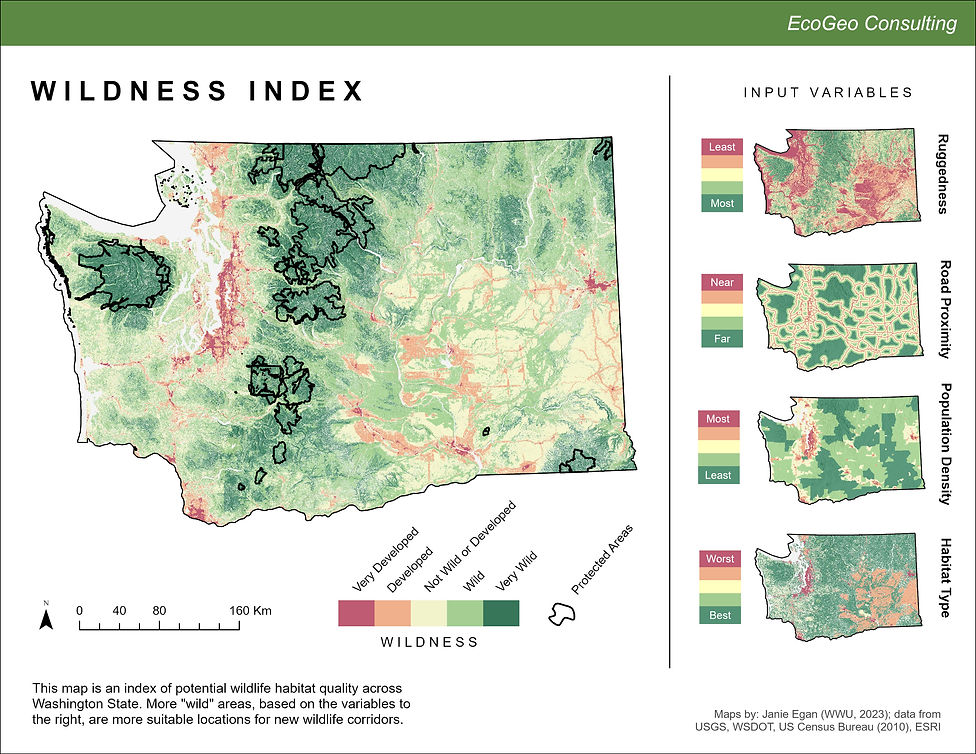
The aim of this analysis was to propose paths for new wildlife corridors between protected areas in the state of Washington as a part of my GIS Certificate program at Western Washington University. I designed a model to create a "wildness index" by normalizing derived variables from several datasets relating to habitat suitability for wildlife. I then used this normalized index to create a cost surface with which I calculated the accumulated distance between large protected regions. The output is a series of lines representing optimal new wildlife corridors, which support sustainable ecosystems by diversifying the gene pool and distributing resource depletion. The layouts below outline my process and display my final results.


bottom of page